PLAN OVERVIEW
Central Jordan River Reconnect
The Central Jordan River Reconnect Master Plan is an effort to reimagine a seven-mile stretch of the river as a more connected, healthy, and welcoming resource for everyone who lives, works, and recreates in the valley. Led by Salt Lake County and shaped in partnership with five municipalities, regional agencies, and community members, the plan looks at how this corridor can better serve both people and the natural systems that define it. Over the past year, our team has been listening—to residents who use the river every day, to city staff who manage it, and to regional partners who understand its challenges and potential. What we’ve heard is consistent: people want a safer and more accessible river trail, healthier habitat and water quality, more ways to reach and enjoy the water, and clearer long-term strategies for maintenance and stewardship.
This plan brings those ideas together into a shared vision for the corridor’s future. It identifies opportunities large and small—from ecological restoration and expanded trails to new access points, program areas, and coordinated management approaches—that collectively improve the river experience across jurisdictional boundaries. While each city has its own priorities, the plan works to align them into a cohesive, connected system that reflects the needs and aspirations of the broader community.
To watch the presentation of the Plan Overview to the Jordan River Commission's Technical Advisory Committee, click on the button below.
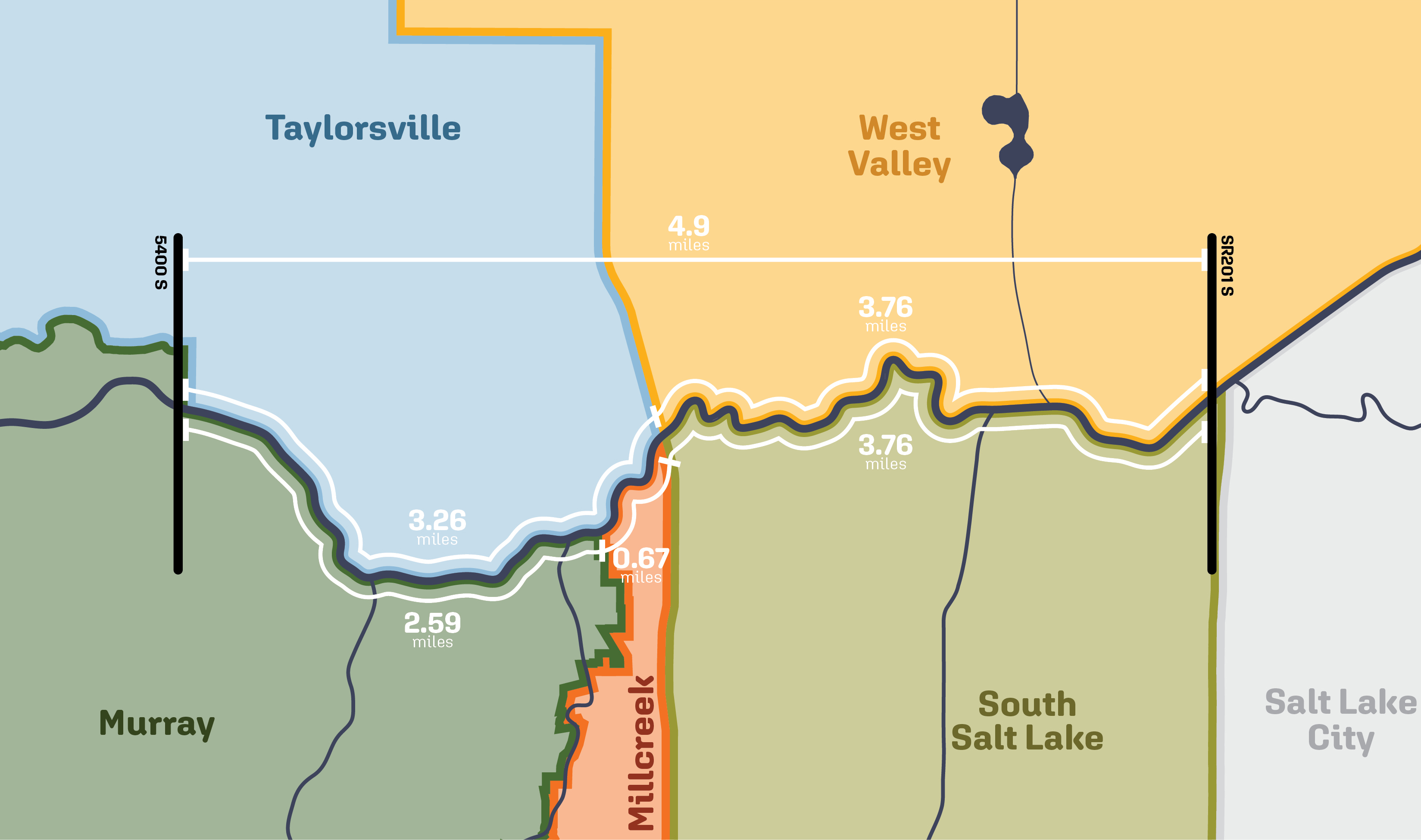
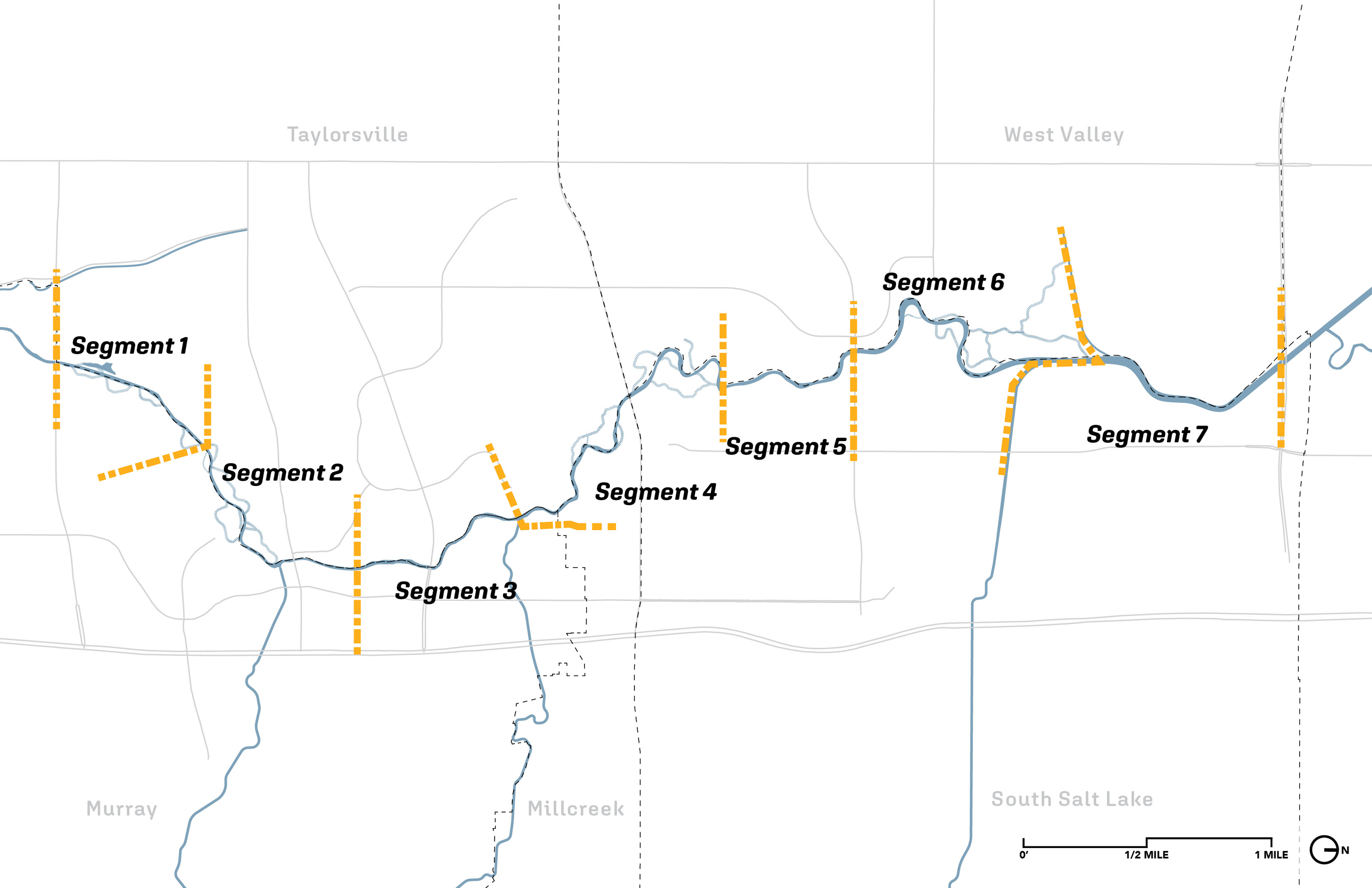
Where the Plan Focuses
Amended through House Bill 173 (2022), the Jordan River Recreation Area was officially designated as a recreation zone between SR-201 and 5400 South—extending 250 yards on each side of the river—and enabling state investment in safety, recreation, and conservation improvements along this section of the river corridor.
Community & Stakeholder Engagement
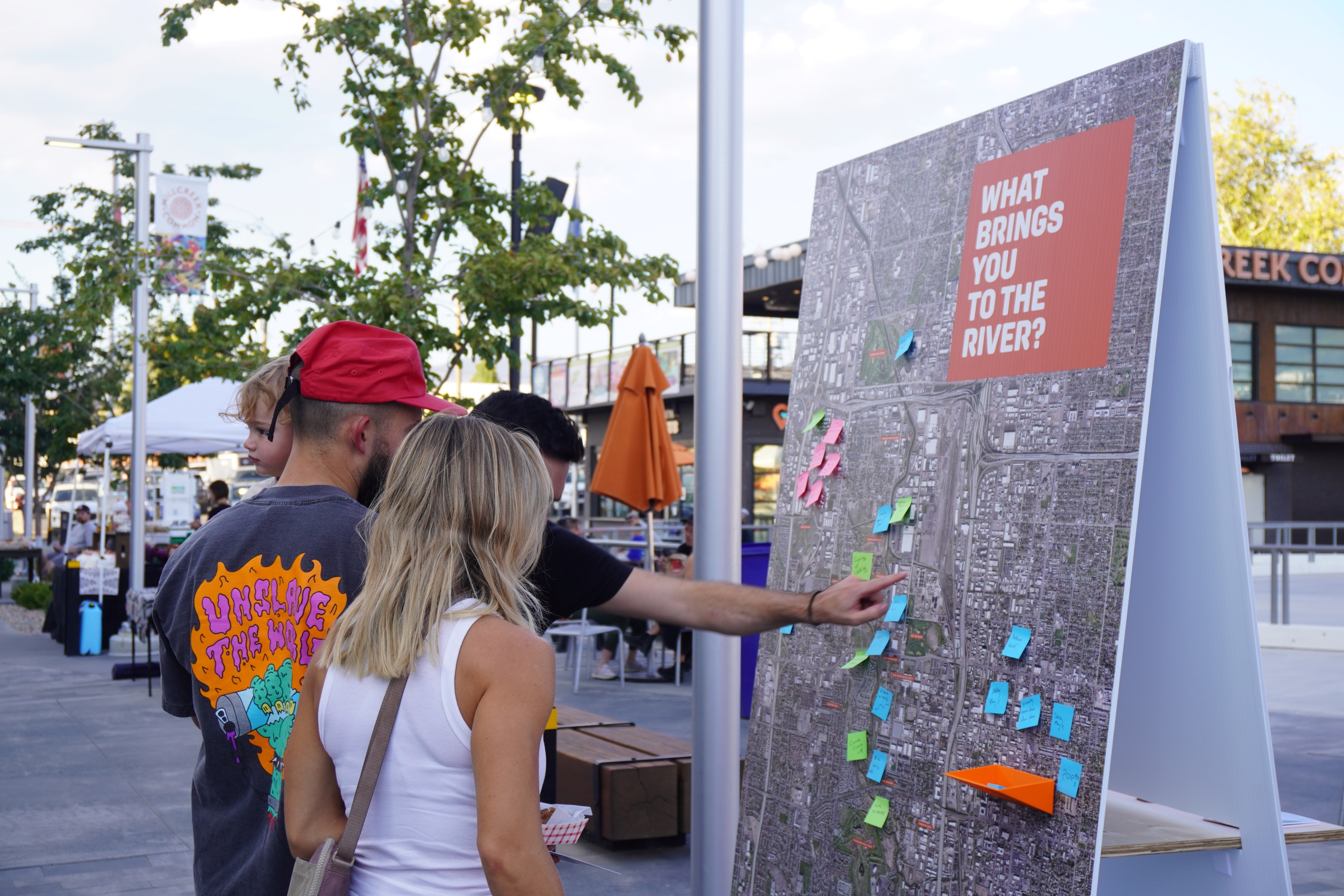
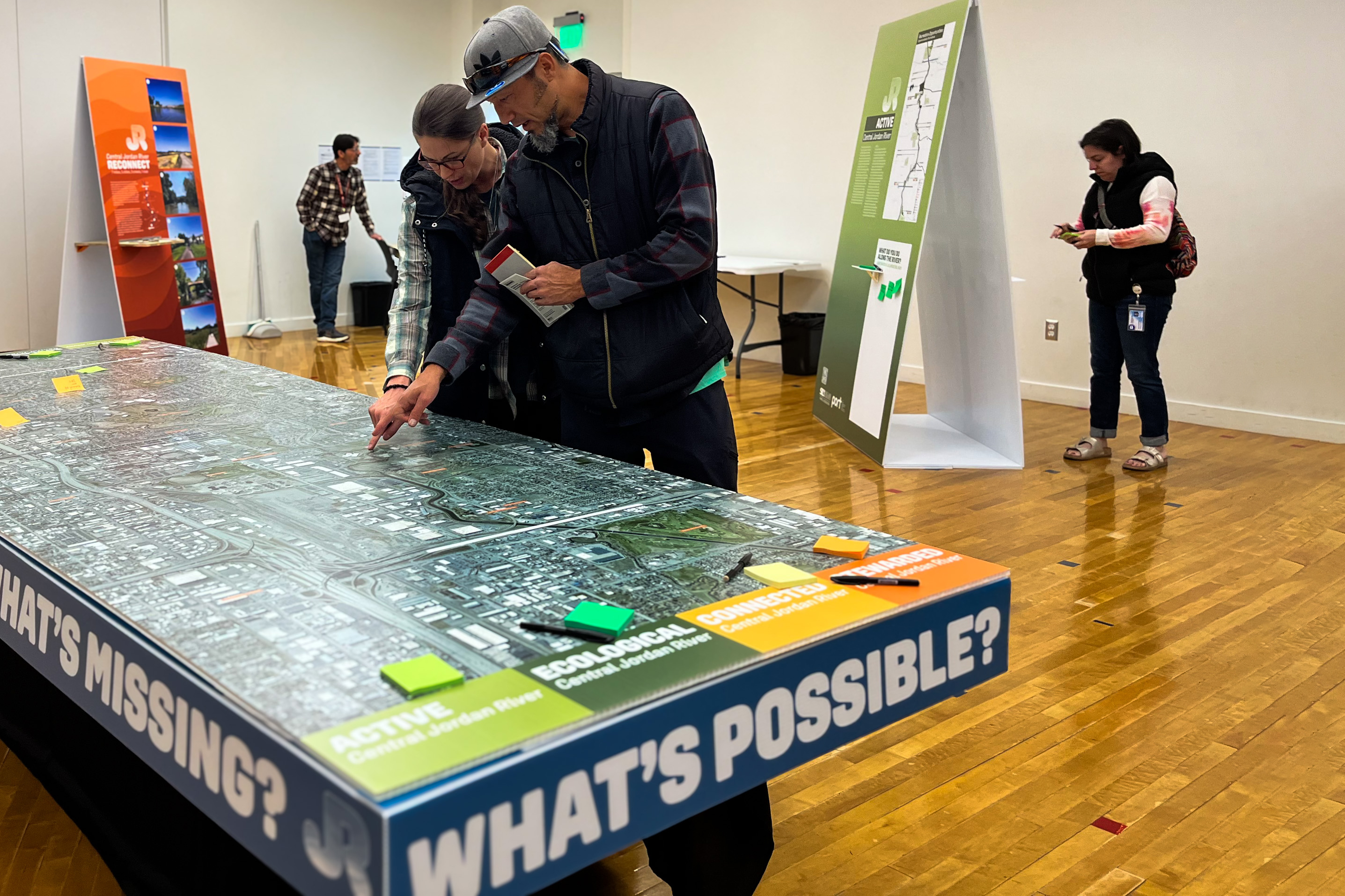
From the start, this plan has been guided by the people who know the river best. Throughout the summer and fall, the project team met residents where they already spend time—at trailheads, parks, community events, and neighborhood gatherings—to learn how they use the Jordan River and what would make it feel more inviting, safe, and accessible. These pop-up conversations, open houses, and online tools helped identify both day-to-day challenges and opportunities to restore the river and expand recreation.
In parallel, the team worked closely with staff from the five cities, Salt Lake County, and regional partners through stakeholder workshops and technical advisory meetings. These sessions aligned city priorities, active projects, ecological considerations, and long-term maintenance needs. Together, this input shaped the plan’s core priorities and areas of shared focus across jurisdictions. The themes that emerged—connectivity, habitat health, water access, safety, and long-term stewardship—form the foundation of the framework presented here and will guide the plan through its next stages.
To download the Community Engagement Report, click on the button below:
Community + Stakeholder Identified Priorities
Active Transportation
Improving access to and along the river, diversifying modes of transit.
Riverine + Ecological Function
Improving water quality and river health, improving the riparian ecosystem and provision of habitat
Recreation Planning
Improving opportunities for passive and active recreation
Management + Safety
Improving safety, visibility, and maintenance through coordinated management and stewardship along the river corridor
System Wide Goals
The themes that surfaced through conversations with the public and stakeholders helped establish a clear set of systemwide goals for the corridor. Each drawing highlights one of these core themes—connectivity, habitat health, water access, safety, and long-term stewardship—and illustrates how these ideas can be applied consistently from one jurisdiction to the next. Together, they show how targeted improvements can work in concert to strengthen the Jordan River as a unified, resilient, and accessible public asset.
Connected Communities
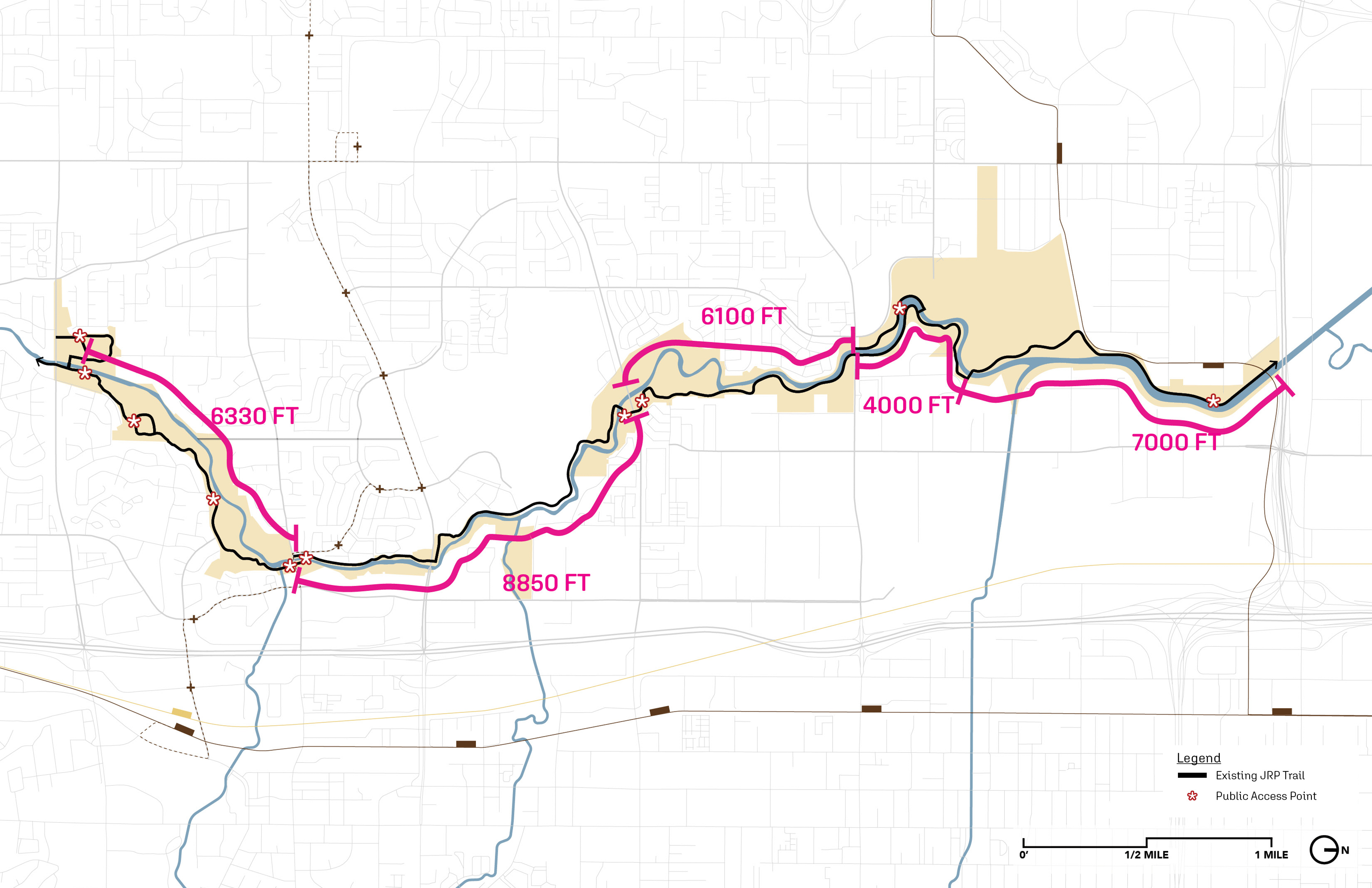
Increased Water Access + Continuity
The Connected Communities diagram highlights where the Jordan River Parkway Trail currently exists on only one side of the river and identifies long gaps between public access points. By closing these trail and access gaps, the plan strengthens east–west neighborhood connections, improves safety and visibility, and supports a more continuous, intuitive experience along the corridor.
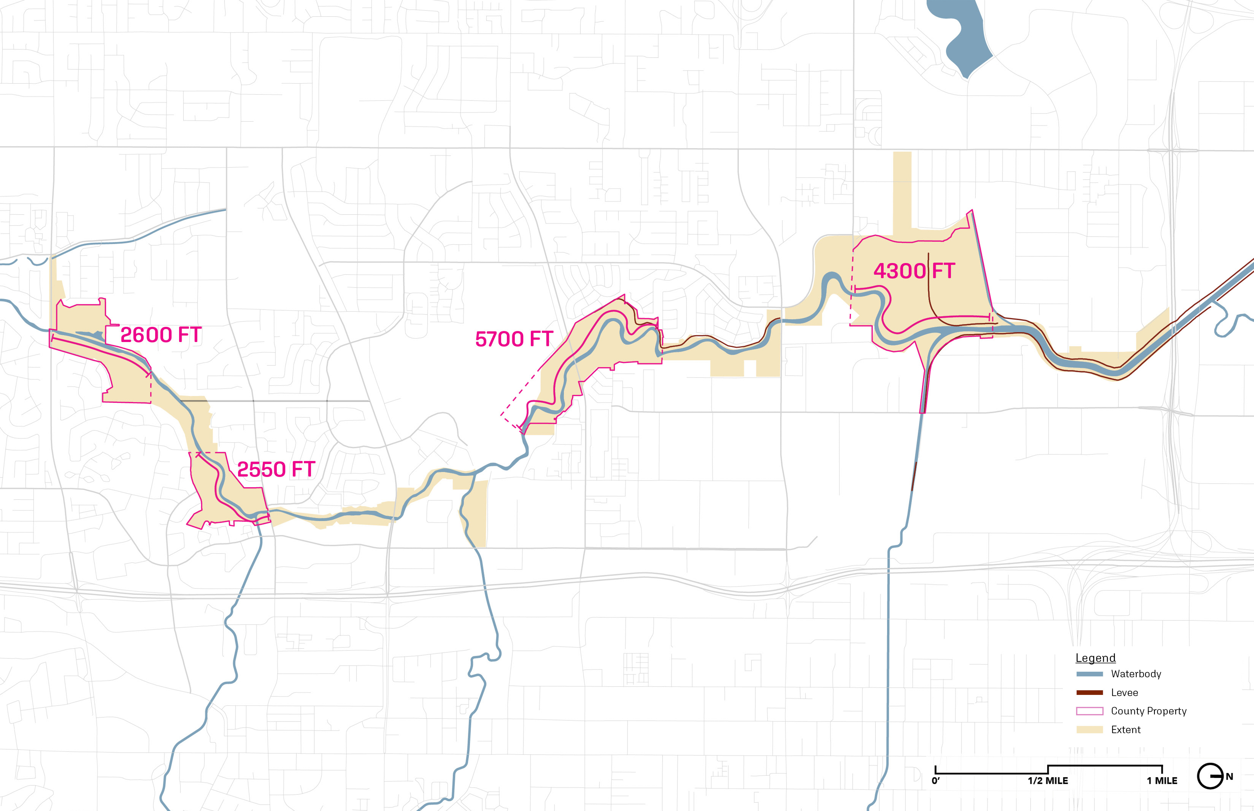
Healthy River Corridor
Primary Ecological Enhancement Areas
The Healthy River Corridor diagram identifies key areas where ecological restoration can meaningfully improve habitat, water quality, and overall river function. By focusing enhancements on publicly administered lands—such as reestablishing floodplain connections, introducing side channels, and strengthening riparian vegetation—the plan supports a more resilient river system and lays the groundwork for long-term habitat health throughout the corridor.
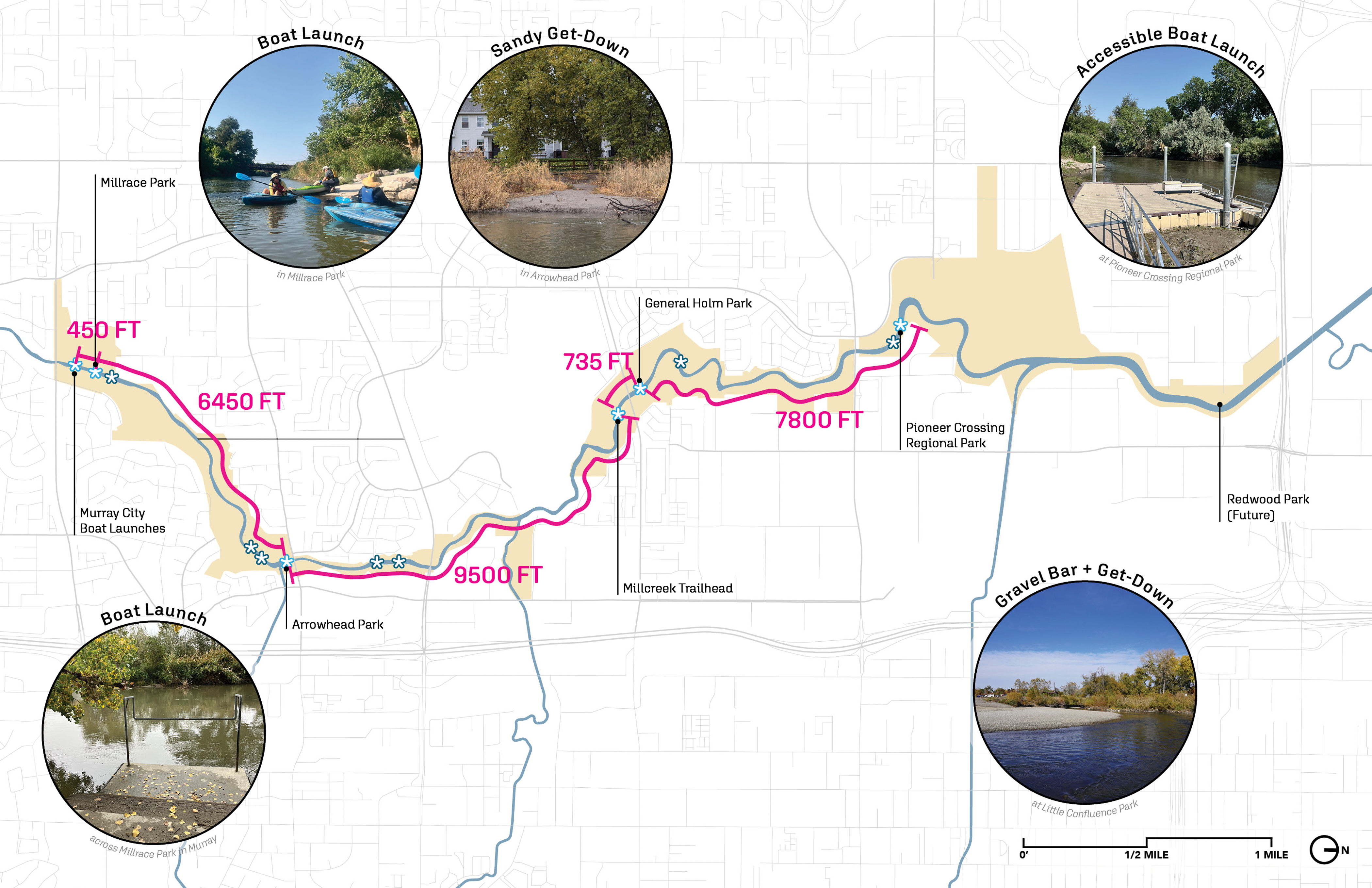
Active River
Increased Water Access + Continuity
The Active River goal focuses on expanding opportunities for people to directly experience the water. Building from existing boat launches and get-downs, the plan identifies where new access points can strengthen continuity and support a wider range of recreation. Enhancing these touchpoints creates a more engaging corridor, ensuring residents and visitors can safely reach and enjoy the river in ways that feel connected and intuitive.
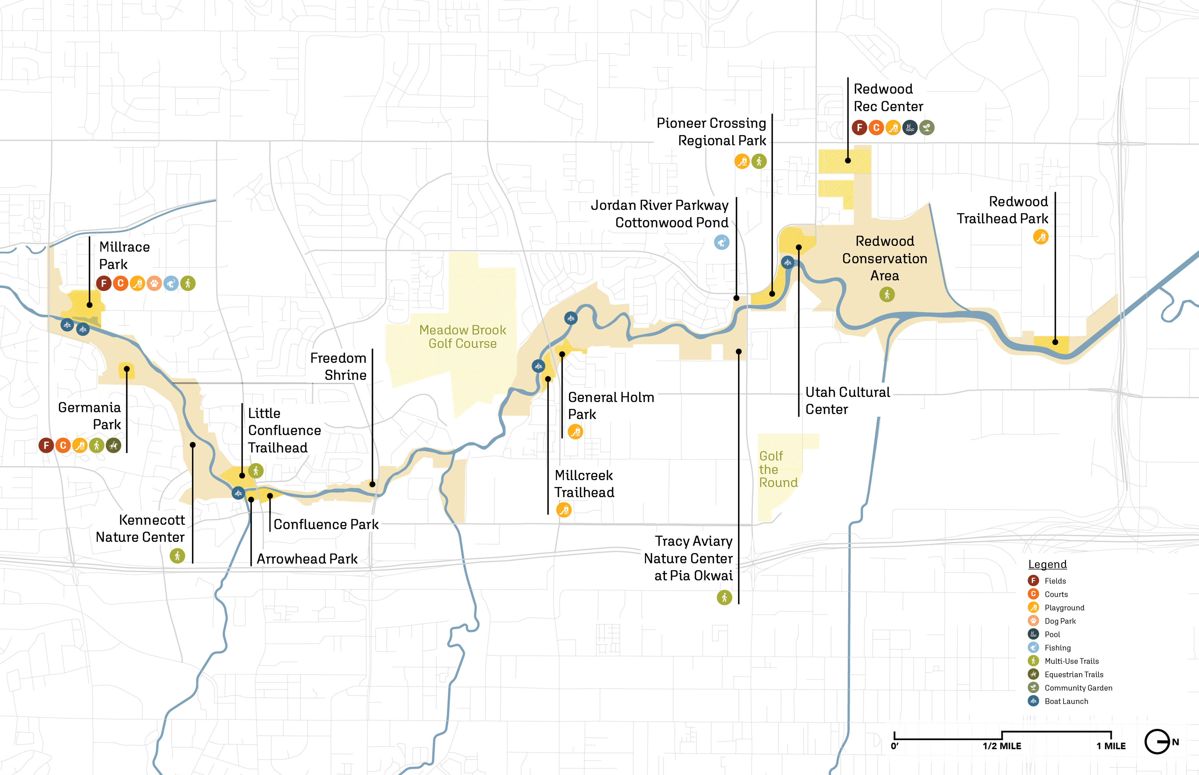
Equitable + Welcoming Spaces
Enhance Riverside Public Amenities
This goal reflects the community’s desire for a river corridor that feels inviting, inclusive, and comfortable. By building on the parks, cultural destinations, and amenities already along the river, the plan highlights ways to enhance public spaces, improve safety, and expand passive recreation. These changes help create a river environment where people of all ages and backgrounds feel welcome and able to use the corridor more often.
Operations + Management
Collaborative Management + Funding Approach
Long-term success of the corridor depends on consistent maintenance, clear responsibilities, and coordinated oversight—needs emphasized throughout stakeholder discussions. This goal outlines opportunities for more unified management across jurisdictions, creating a framework for shared operations, stewardship, and programming. A cohesive structure strengthens safety, identity, and the overall experience of the Jordan River.
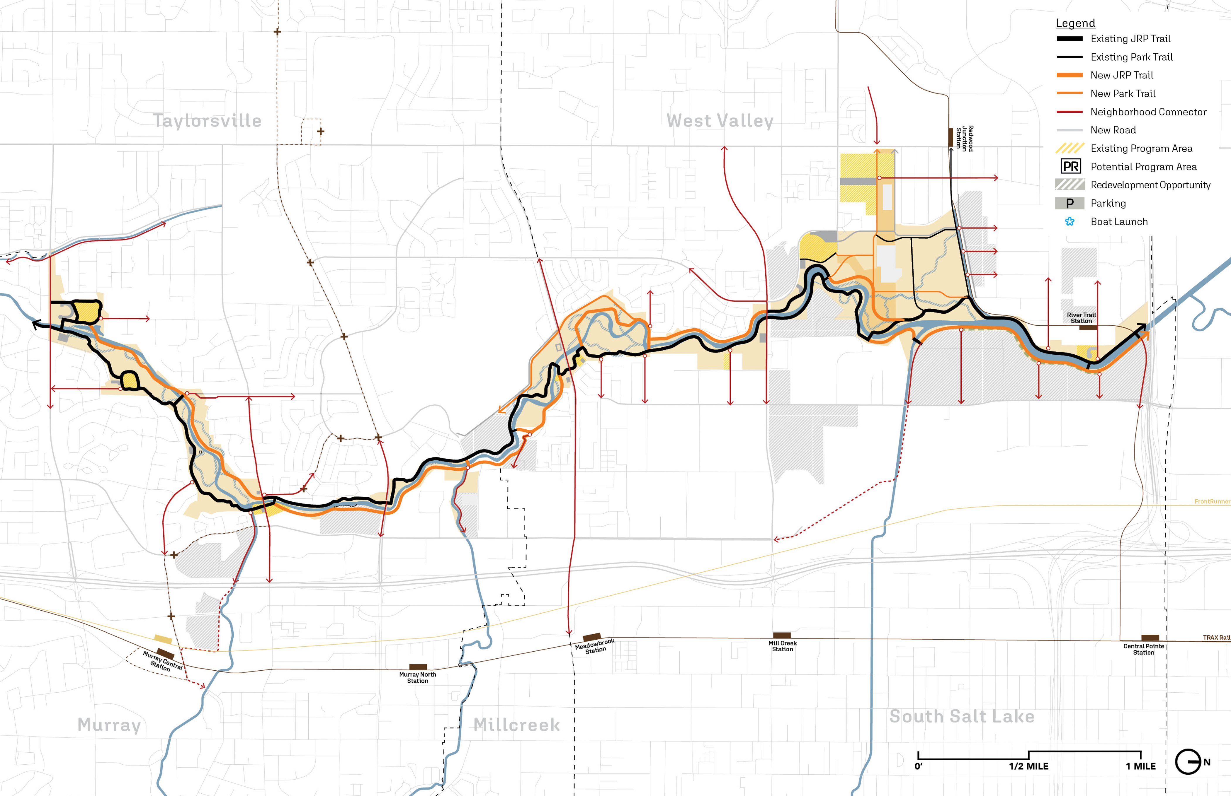
Framework Plan
The Framework Plan brings together the full range of ideas, priorities, and ongoing efforts shared by the five jurisdictions, Salt Lake County, and regional partners during our interactive workshops. By combining public input with city-led projects, ecological considerations, and long-term operational needs, the plan establishes a cohesive vision for the corridor as a whole. It aligns individual goals into a connected system—identifying where trails, access points, restoration opportunities, and program areas can reinforce one another and create a stronger, more resilient Jordan River experience for all.
Each element shown in this framework reflects direct input gathered through our workshops with the five cities, Salt Lake County, and technical partners. Using these conversations as a guide, the team mapped where shared goals—such as improved access, stronger habitat, safer connections, and clearer management—could be advanced in every segment of the corridor.